Monday, 18 November 2013

Fieldtrip, November 24th 2013

Laxton Field Trip.  Sunday 24th November 2013

Friends, family, etc welcome - including children who can cope with a bit of a walk!  Dogs will be fine if kept on a lead as we may encounter livestock.

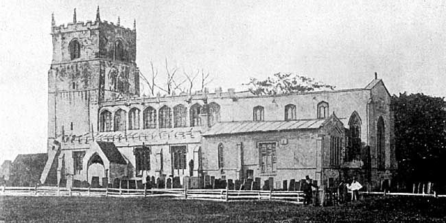
Meet at the Visitors' Centre at 12 noon for a walk around the village and Church. 

Lunch in the Dovecote Inn (if required) food from 12.30pm Sunday (booking essential).  www.dovecoteinnlaxton.co.uk (nb 10% discount if booked on-line!). Tel: 01777 871586

Alternatively, picnic in the visitors' centre.

We will reconvene at 1.30pm to explore the castle and field system, finishing at dusk (about 4pm).


Directions

Sat-Nav: NG22 0SX (but allegedly unreliable)

From Nottingham take the A614 north to Ollerton.  At the outskirts of Ollerton take the 4th exit from the roundabout (marked A616 Ollerton).

At the next roundabout take the first exit (A6075) into Ollerton.  Continue through Ollerton on the A6075.

As you leave Ollerton, passing through some industrial and manufacturing buildings, the main road turns sharply to the left, with a minor road on the right (Cocking Hill) passing steeply uphill under a railway bridge.

Follow the minor road uphill (you are climbing up one side of the Mercia Mudstone ridge that forms the spine of Nottingham).

At the brow of the hill you enter Laxton parish, passing across the Westwood Common (enclosed in the 1950s).  The woodland on the left at the heart of the old common has existed since at least 1635 and was mapped by Mark Pearce.

Follow the road as it winds down into Laxton village.

Continue through the village, passing the parish Church on your right.

About 200 yards past the Church the road forks at a small triangular green (Crosshill).

You will see the Dovecote Inn ahead and to the right.  Follow the road round to the right and turn left into the car park.

Park at the far end of the car park (uphill).  The visitors' centre is immediately opposite the pub entrance.

Bring

Maps, notebook, camera, GPS
Warm, waterproof clothing
A flask and a snack.  There are no shops or tea shops in Laxton!
Walking boots and gaiters or wellington boots preferred. It can be muddy underfoot so shoes are NOT recommended
A good walking stick/staff/shooting stick is not a bad idea either if you have one.

Understanding the Archaeology of Landscapes

English Heritage's excellent and free introduction to landscape archaeology Undertanding the Archaeology of Landscapes is available to download from their website.

English Heritage also produce a wide variety of free guidance booklets, some highly specialist, but many of more general interest, which can be accessed from here.

Class 9: Preparing for Fieldwork

The slides for Class 9: Preparing for Fieldwork are available to download from here.


Monday, 11 November 2013

A Field trip to Laxton

In the Autumn of 1902 the Thoroton Society hosted a field visit to Laxton (in the rain!) and then the propert of Earl Manvers.  The visit was reported upon in the Transactions of that year.

After passing through Moorhouse, Laxton Fields, where the open-field system of agriculture still survives in a modified form, were traversed in a drenching shower.  This property belongs to Earl Manvers, and at a later period in the day, Mr. W. Stevenson took an opportunity of explaining the leading features of this old communal system of agriculture, which still holds its own in this partially unenclosed lordship. It was explained that the wheat field of this year would be a pulse crop next year, and then lie a year in fallow, in the latter case with the broad headlands of grass to become the com­munal sheep pasture of the lordship by which the land would be again prepared for corn... (Read More)


Mark Pierce, Laxton 1635

Below is one panel from Mark Pierce's great 1635 map of Laxton, held by the Bodleian Library, Oxford. Other panels and the terrier (accompany field book) can be viewed on the Oxford Digital Library website and also on their Treasures of the Bodleian website.

George Sanderson's Map of Laxton, 1835

George Sanderson's 1835 map of Twenty Miles Round Mansfield provides a fantastic introduction to historic mapping.  Published by subscription just before the first Ordnance Survey map of Nottinghamshire, but at a larger scale of about two and a quarter inches to the mile, Sanderson, who worked variously as a surveyor and Enclosure commissioner, based his map on his own surveys of the countryside.  Beautifully drawn, the map captures an early 19th century landscape in transition.  The open fields are largely gone, but Nottingham still sits among fields, the Park is still a deer park, and the railways just a threatened line across the landscape (often wrongly placed as the routes were changed after Sanderson published his map).

The whole map has been republished several times, most recently in 2001 as a two book reprint by Nottinghamshire and Derbyshire Library Services, which is sometimes to be found in bookshops and is well worth having if spotted.  Below is a zoomable extract for the parish of Laxton, compare with the modern Ordnance Survey mapping to try and discern just what has changed in Laxton over the past 180 years.


Class 8: An Unexpected Corner

The slides for Class 8: An Unexpected Corner, Hoskins on Towns are now available from here.


Thursday, 7 November 2013

Laxton Manuscripts at the University of Nottingham

The Manuscripts and Special Collections section of the University of Nottingham Library hosts a dedicated website presenting part of their extensive collection of documents relating to Laxton. The website explores aspects of life in Laxton between 1635 and 1908. Despite the fact that Laxton was never fully enclosed, it was a typical example of a Midlands open field village and its history can therefore shed light on life in hundreds of similar places.

The resources include images and transcripts of original archive materials including maps, surveys, manorial and ecclesiastical court records, correspondence and reports. 

Monday, 4 November 2013

Class 7: A Desirable Spot to Build

The slides for Class 7: A Desirable Spot to Build, are available for download from here.


Monday, 28 October 2013

A Short History of Enclosure in Britain

In an excellent article in The Land Simon Fairlie describes how the progressive enclosure of commons over several centuries has deprived most of the British people of access to agricultural land. The historical process bears little relationship to the “Tragedy of the Commons”, the theory which ideologues in the neoliberal era adopted as part of a smear campaign against common property institutions.

Over the course of a few hundred years, much of Britain's land has been privatized — that is to say taken out of some form of collective ownership and management and handed over to individuals. Currently, in our "property-owning democracy", nearly half the country is owned by 40,000 land millionaires, or 0.06 per cent of the population,1 while most of the rest of us spend half our working lives paying off the debt on a patch of land barely large enough to accommodate a dwelling and a washing line. Read More.

Ancient Trees in Sheringham Park

One of a series of short films by the National Trust, the clip below discusses evidence for ancient woodland in Sheringham Park, North Norfolk.


Class 6: A Curse Upon the Land

The slides for Class 6: Parliamentary Enclosure, a Curse Upon the Land, are available for download from here.


Monday, 21 October 2013

Laxton Maps at the University of Nottingham

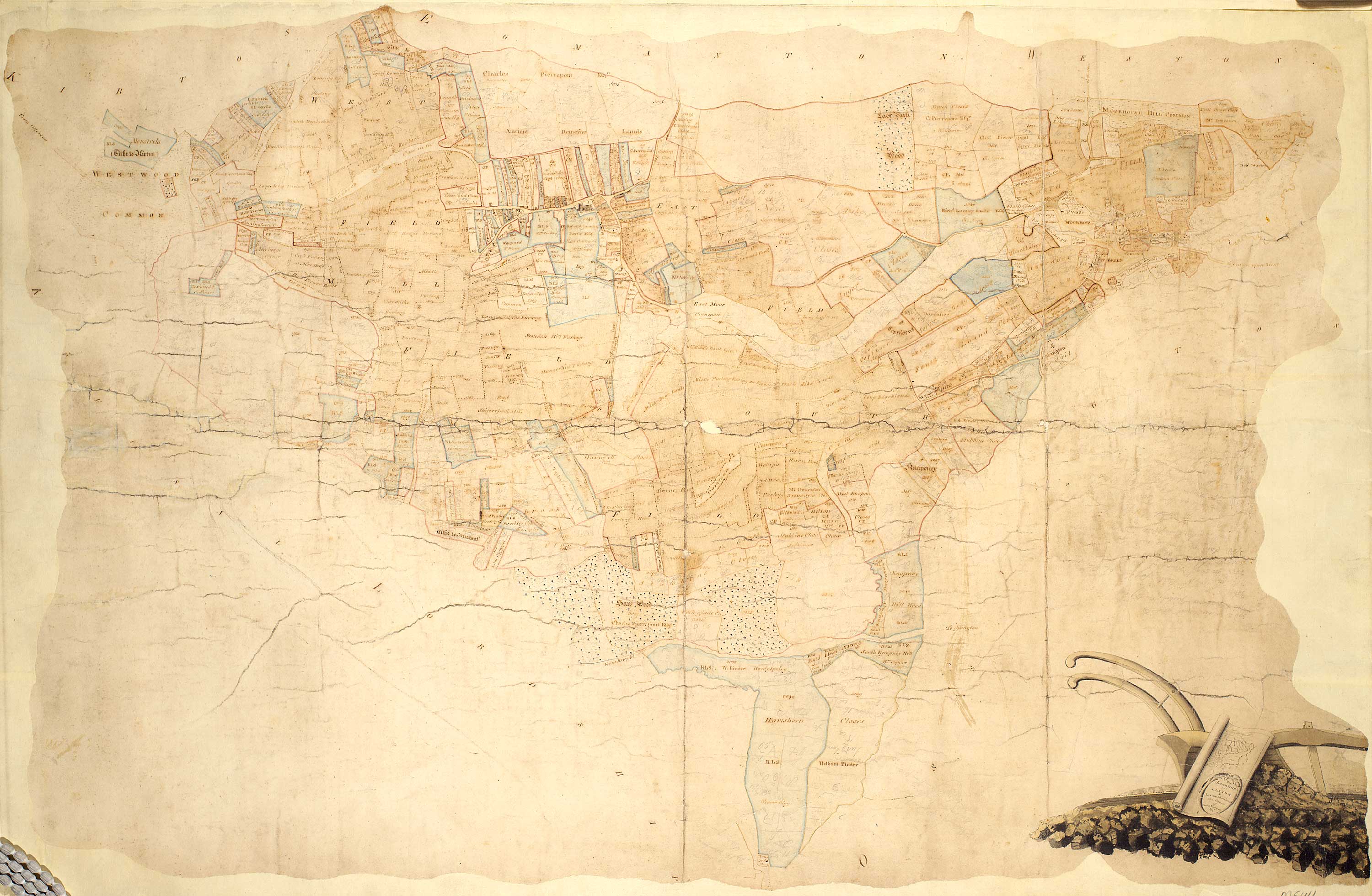
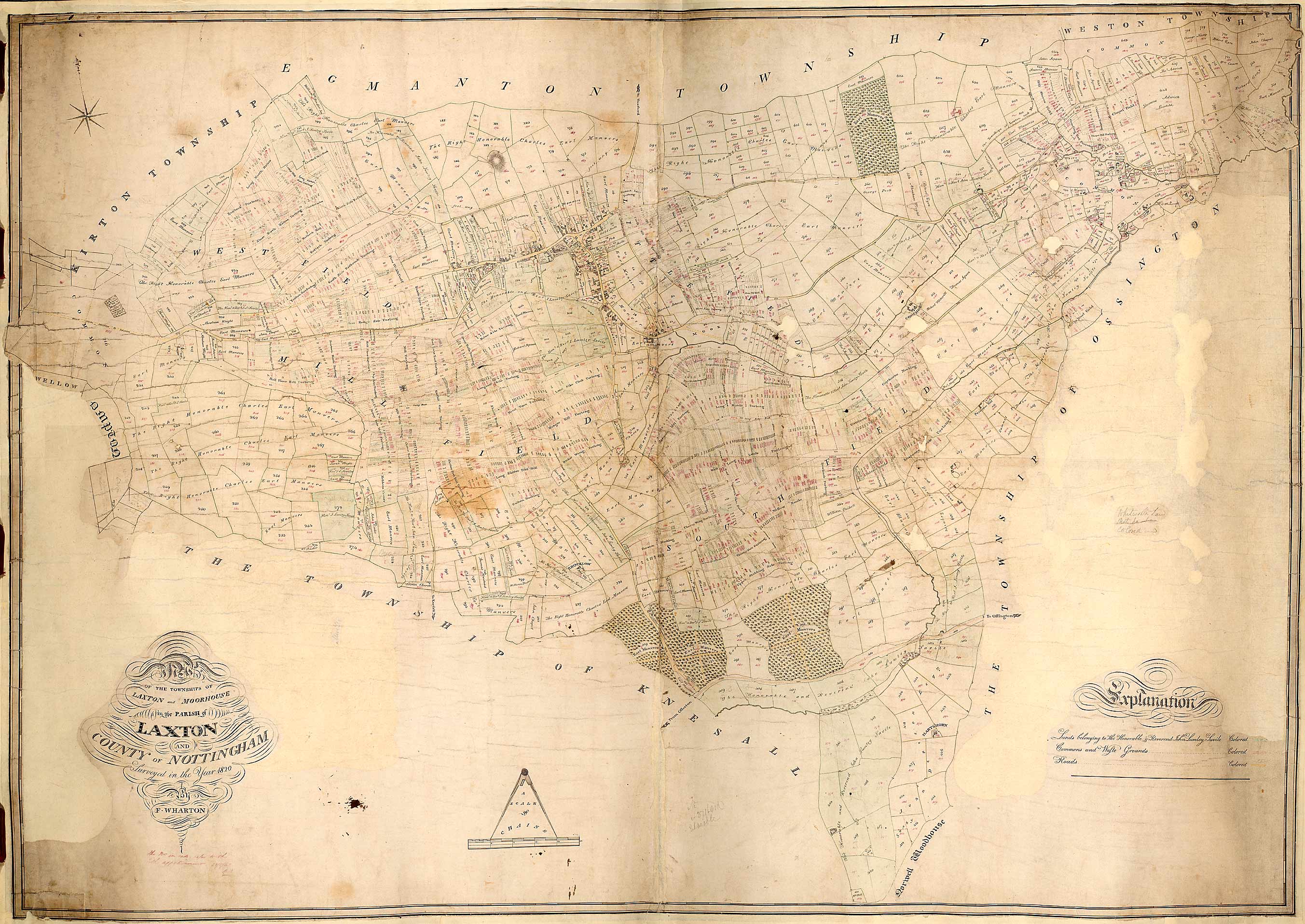
The Department of Manuscripts and Special Collections at Nottingham University Library holds a large collection of material relating to Laxton, including many maps. Here are three fine maps spanning the 18th and 19th centuries, reproduced on their Laxton focused web-based collection of primary materials.

Hand-drawn and coloured map of the lordship of Laxton and Laxton Moorhouse, 1789

Hand-drawn map of the parish of Laxton, 1820


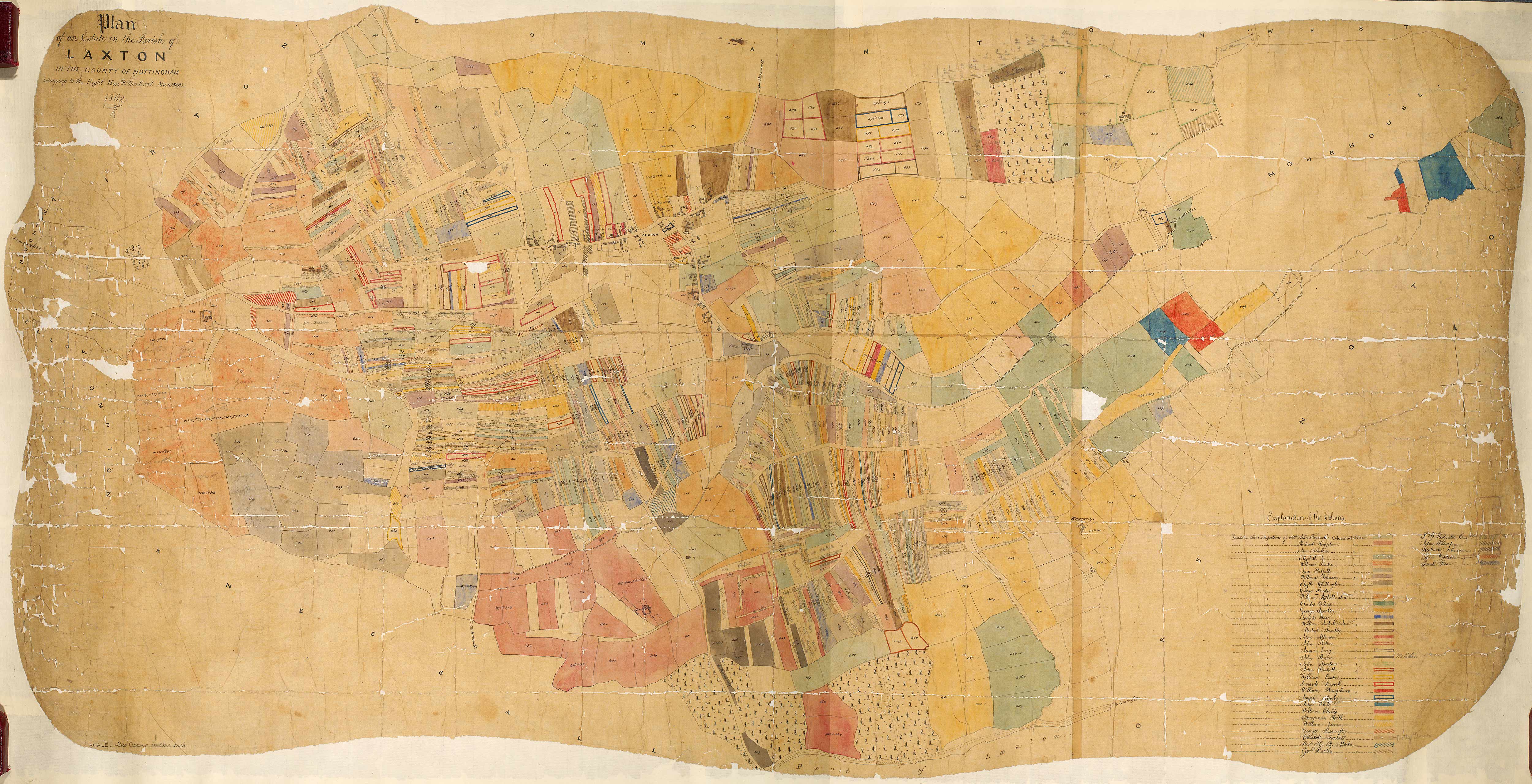
Hand-drawn and coloured plan of Earl Manvers’ estate in Laxton, 1862


Map Regression Exercise

Map Regression is an important tool for exploring and understanding the development of landscape. Laxton is fortunate in having a wealth of historic mapping, allowing analysis of landscape change and development at a high resolution. 

You can compare two of the principal sources of mapping that of Mark Pierce (1635) and George Sanderson (1835) using the interactive maps on this website.

Map Regression Exercise
Using the historic mapping of Laxton provided below trace the development of either Town End Farm or Church Farm. 


Your aim is to understand the origin and antiquity of features of the modern landscape – so aim to produce a map of the present farm that demonstrates these two based on you map analysis.  You might care to visit the English Heritage website to investigate the context for such analysis of historic farms.

Treasures of the Bodleian: Mark Pierce's Map of Laxton

Mark Pierce's wonderful 1635 map of Laxton is owned by the Bodliean Library at the University of Oxford. Here the Nick Millea the map librarian  introduces the map in all its glory.

Class 5: An Excess of Sheep

The slides for Class 5: An Excess of Sheep can be downloaded from here.

.

Tuesday, 15 October 2013

Class 4: Awaiting the Sound of a Human Voice

The slides for Class 4: Awaiting the Sound of a Human Voice can be downloaded from here.


Domesday Book

William of Normandy's great survey of England is a fascinating source of evidence for the social, political and economic organisation of late 11th century England.  This complex and much studied documents continues to yield new insights into the landscape and society of Saxo-Norman England.


The National Archives guide to Domesday is a good starting point for study.  There are also several on-line versions of the book (beware those that try to charge you for an extract). The best is domesdaymap.co.uk. Here you can search by place and person, view facsimile images of the original folio volume, read a digest of each entry and generate your own interactive maps. Below for example is the entry for Geoffrey Alselin, Lord of Laxton in 1086.


There is also an interesting report by English Heritage on mapping Domesday data: Lowerre, A. 2008. Mapping Domesday Book using GIS. Research News: Newsletter of the English Heritage Research Department. Number 8, which may be downloaded from here.  And as if that wasn't enough, Darby and Maxwell's classic Domesday Geography of Northern England is available as a free Google E-book from here.

Wednesday, 9 October 2013

Class 3: Becoming a Land of Villages

Belatedly, here are the slides for this week's class, Becoming a Land of Villages, with in particular, details of the types, uses and evidence that may be gleaned from aerial photography.


Hoskins's England:A Local Historian of Genius

Charles Pythian-Adam's appreciation of Hoskins's life and legacy was published in the Transactions of the Leicestershire Archaeological and Historical Society after Hoskins's death in 1992.  You can read the full text here.

Hoskin's published much of his early research in TLAHS.  It makes fascinating reading in its own right and it is possible to see his great themes, expounded in Making of the English Landscape, beginning to emerge.

You can download and read all of Hoskins's early works from the LAHS website, search the pre-War volumes for the majority of his work.